WH-MAVS数据集是目前为止唯一一个围绕特大城市中心区域进行标注的,大范围、面向多应用、多时相的、带有地理坐标的场景分类数据集。该数据集不仅可以进行场景分类和场景变化检测的方法理论研究与验证,而且可以直接应用于土地利用与土地覆盖的实际生产,如城市制图与规划、景观生态学分析以及城市环境动态监测等领域,从而实现从算法到应用的“应用鸿沟”的跨越。
本数据集主要从Google Earth 影像上获取,空间分辨率1.2 m,影像大小为 4753738100 像素的大尺寸高分辨率遥感影像。覆盖范围为中国武汉市中心城区,覆盖面积超过6800 km2。影像分别获取于2014年和2016年,包含红、绿、蓝三个波段。数据集在原始影像上以每个影像块大小为 200200 像素不重叠的剪裁,且两个时相所有的样本地理坐标一一对应,每个时相包括23,202个未变化区域样本和365个变化样本。
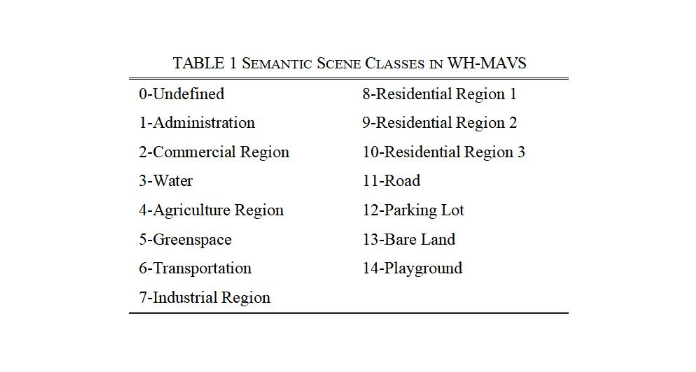
整个数据集的训练样本、验证样本以及测试样本都是在大尺度高分辨率遥感影像中选取产生的。每个时相数据样本量有23,567个,WH-MAVS 数据集总共47,134个样本。每个时相训练集包括16,496幅影像块,验证集包括4,713幅影像块测试集包括2,356张影像。训练集、验证集和测试集的场景影像块共划分为以下14个类别:
数据集下载 (下载链接即将发布)
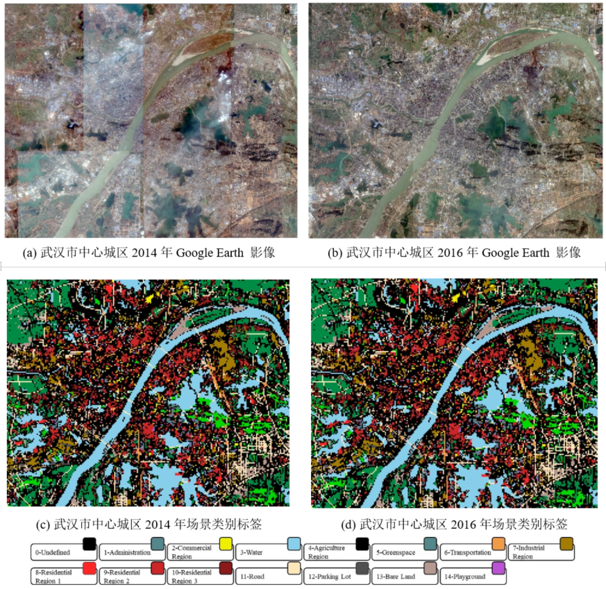
数据集整体图像和场景类别概览如下图所示(更多信息请参考README文件):
数据集的每类样本数的分布非常不平衡,存在较大的类内差异和不可区分的类间方差,更接近实际的LULC应用任务,给相关算法研究带来了更多的挑战,各类别样本样例如下所示:
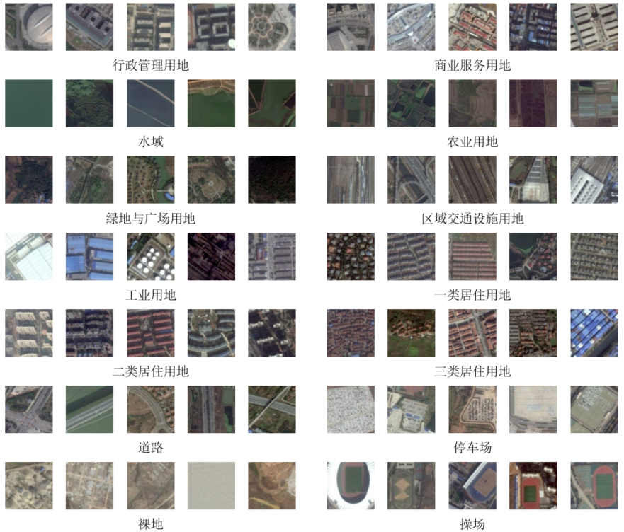
WH-MAVS数据集各类别样例
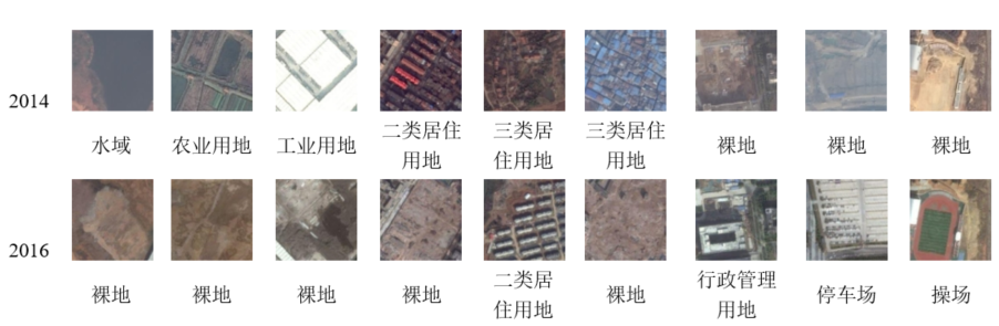
WH-MAVS场景变化检测结果样例
本数据集的版权属于武汉大学地学智能感知与机器学习研究组SIGMA(Sensing Intelligence, Geoscience and MAchine learning lab, http://sigma.whu.edu.cn/)。WH-MAVS数据集仅被授权应用于公开发表的科学研究和学术论文中。如果您在研究中有其它问题,请联系武汉大学SIGMA小组。联系方式:chen.wu@whu.edu.cn
下载链接: https://share.weiyun.com/nsYPzoCb
密码:u3i8fg
English Version
Wuhan Multi-Application VHR Scene classification data set (WH-MAVS)
The WH-MAVS dataset is a large-range, multi-application, multi-temporal, and georeferenced high-resolution scene classification dataset annotated covering almost an entire mega-city so far. The dataset not only can facilitate the theoretical research of scene classification and scene change detection methods, but also can be directly applied to the practical production of land use/land cover (such as urban mapping, landscape ecology analysis, and urban environmental dynamic monitoring). Thus, the “application gap” from algorithm to application can be crossed.
Our dataset is acquired from Google Earth images with a spatial resolution of 1.2 m. The image is a large-range, high-resolution remote sensing image with a size of 4753738100 pixels. The study area is the central city of Wuhan (Hubei Province, China) covering an area of more than 2608 km2. The images were acquired in 2014 and 2016, containing red, green, and blue bands. We cropped the original images with each image patch size of 200200 pixels without overlapping. All samples of two-time phases correspond one-to-one geographically, and each time phase includes 23,202 samples of unchanged areas and 365 changed ones.
Samples for training, validation, and testing were randomly selected from WH-MAVS. The number of patches of each temporal is 23,567, and the total number of patches in the WH-MAVS dataset is 47,134. Each temporal training set has 16,496 image patches, and the validation set has 4,713 image patches, and the test set has 2,356 images. The image patches of the WH-MAVS dataset are divided into 14 categories as follows:
Dataset Download (Link is coming soon...)
Acquisition and distribution of a large-range, high-resolution and multi-application SC dataset– WH-MAVS (for more information, please refer to the README file).
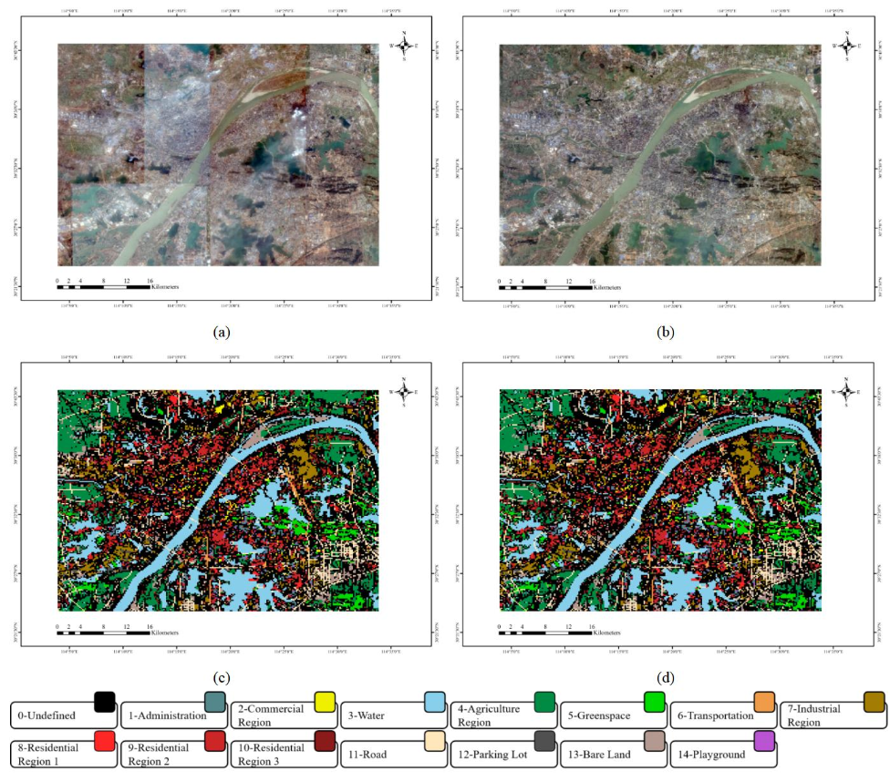
Figure.1. Acquisition and distribution of a large-range, high-resolution and multi-application SC dataset, “WH-MAVS”. A fusion image of the central area of Wuhan, obtained in (a) 2014 and (b) 2016. Images (c) and (d) represent the spatial layout of the WH-MAVS dataset in 2014 and 2016, respectively.
The WH-MAVS dataset has a very significant imbalance of classes, with large intra-class variation and indistinguishable inter-class differentiation. It is closer to the real-life LULC application task and brings more challenges to the related algorithm research. The sample examples for each class as presented below.
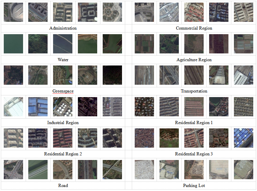
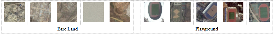
Figure. 2. Sample patches of WH-MAVS.
The copyright of the WH-MAVS dataset belongs to SIGMA (Sensing Intelligence, Geoscience and MAchine learning lab, http://sigma.whu.edu.cn/). The WH-MAVS dataset is only authorized to be used in published scientific research and academic papers. If you have any questions in the research, please contact the SIGMA group at Wuhan University. Contact: chen.wu@whu.edu.cn
Download link: https://share.weiyun.com/nsYPzoCb
Password:u3i8fg